My Pyrenees HRP Diary - Introduction

This blog was begun in 2015, to record my walk along the Pyrenees HRP from Hendaye to Banyuls. If you want to read about that, I suggest you start here.

But that is all in the past now, and I have expanded the blog a little to cover more recent events.. such as:

Pennine Way 2024
Snowdonia Way 2017
Hebden Bridge 2015
Equipment Reviews
North Downs Way 2017
Pennine Way 2019

I hope you will find something interesting. Please do provide a little feedback or comment, and if you are interested in something that I didn't say enough about, please let me know .. happy walking! For posts not about walking, click on "View my complete profile," below right.
Jerry

Friday, 5 June 2015

27 Days to departure! More Logistics...

So, less than a month to departure and I'm sorry to say that I have not made nearly enough progress. The walking preparation itself is going well.. the two three-day walks satisfactorily completed, and I am booked into accommodation in Hebden Bridge for a week from next Friday.

Hebden Bridge is a nice town a few miles from Haworth and the Pennine Way goes past it. It is nothing if not a hilly area, and I am hoping that when I come back I shall be able to motor up hills - as is something of a requirement, in the Pyrenees.

One other thing I shall be doing in Hebden Bridge is to provide daily updates to this blog, via my Samsung Galaxy 5 phone, hopefully with photos, just to see that it is do-able and all working properly..

I am pretty much happy with my gear now, tried and tested on the two three day walks and my previous trips, for example on the Pennine Way last year. I have bought a new smartphone and an external battery that will keep it charged for a week or more. I need that not just for internet updates (and even the odd phone call?) but because this time, all of my maps will be on it, I will go completely paperless apart I think from the Joosten HRP Guide which I must either take or scan into a Word document. Or buy the Kindle edition, which at £12.23 seems steep, but is still better than 320 scans!

One side effect of this is that the phone becomes a vital piece of kit. To the point where I think I might have to take the old s3 phone as backup. Losing the phone or having it just stop working would leave me with no map or guidebook as well as no gps location .. or even phone calls!

Beyond that, little has been done. I still have to book the train tickets and any accommodation needs, and that is my top priority now, I will do that this week. The other high priority is route planning. I need an outline for the trip day by day.. it is not necessary to adhere to it, but the outline must be there because as all chess players know, a bad plan is much better than no plan at all; a bad plan can always be improved but with no plan, you just flounder. I will take my laptop and maps to Hebden Bridge, and hope to work on them in the evenings and come back with a completed outline..


July in the Pyrenees,
2013. I hope not to
have so much snow
this year; but I must cope with what I am given
 The Cirque du Lescun, part of the High Pyrenees... 2013, hence all the snow


Friends.. even though I set off and walk on my own, and the Pyrenees is not a busy part of the world, it is surprising how many people you meet and talk to.. and have things in common with. Arne (on the right) and John at the back are friends I am still in touch with. Trying to remember where this was.. Lescun maybe


Monday, 6 April 2015

84 Days to departure! Logistics...

A Hunters Cabin near the Col d'Ibardin, where I spent my first night in the Pyrenees in 2010 (that's my tent and rucksack). It had a water source, a barbecue, and several other walkers...

I don't like planning walks; really I just want to set off and get started. But some planning is unavoidable. This post should provide a checklist of the minimum that needs to be done...

First of all I must set dates. Not just for departure, but for preparation and training too - the High Pyrenees is a demanding environment. So here we go:
         
3 day prep walk:              27/28/29 April
3 day prep walk:              13/14/15 May                                          
6 day prep walk:              12/17 June
Depart for Hendaye:         Monday 29 June
Start walking:                  Tuesday 30 June
Finish at Banyuls :            Wednesday 18 August (50 days later)
Home:                            Friday 20 August

The preparation walks are partly for physical training - I will be trying to do 20 miles/day or thereabouts - and also to check out all my gear. I will try to use all the stuff I am going to take to the Pyrenees. Also do some blog updates etc. from my phone.

I've allowed 50 days for the walk itself, but the truth is I have very little idea how long it will take. If I'm feeling fit and press on, I reckon I might walk the 500 miles in no more than 30 days - that is only 16 miles/day after all. However (a) it does go up and down a lot - and this seriously affects how far you can walk in a day. (b) I expect to have a rest now and then. I expect to have three or four "zero days," as required. And also (c) I would like to climb a couple or three of the higher peaks en route: Vignemale, Posets, Aneto.. for example. More about this when I get onto planning the route. The rest of the time is just contingency - it will stop me worrying about running short of time.

The other aspects of logistics planning I need to sort out are:

- booking travel, to and from
- booking accommodation as necessary (only the first day or two probably)
- communications: phones and phone tariffs, blogging etc.

Rather than try to detail those now I will post this update, and then come back and add to it over the next week or so.

Once that is done, the next update should deal with route planning.. or will panic have started to set in?

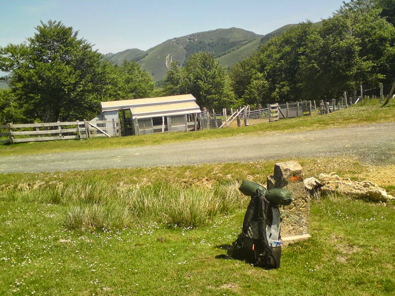
This was supposed to be a small shop, near the Redoute de Lindux. It was firmly closed. Shopping is a tricky business on the HRP. My rucksack is leaning against a stone marking the French/Spanish border


The pilgrims' dormitory in Roncesvalles, 2010. It accommodated 250 people in some discomfort and staying there was quite an experience; but it has since been replaced by a new building


Tuesday, 10 March 2015

Preparation: Making a Plan

Hmm, OK, it seems you must have a plan of sorts, it is expected, but it is not at all my strongest suit. Starting one is no particular problem: make a list! It is all the bits after that I have trouble with. Anyway, here is my initial list. Each of these headings will be the subject of a separate post in due course..

  • Logistics
         - set dates (heavens, do you mean you don't even know when you're going, yet?)
         - book travel to and from (it's getting more expensive by the day, don't forget!)
         - parcel drops en route? (in my case, no, I don't think so)
         - book some accommodation?
         - communications - dealing with mobile phones, emails, blog updates (!) and call
           charges, an issue to be reckoned with

My next blog entry here deals with the logistics

  • Route
         - plot a route, in this case from Hendaye to Banyuls
         - get maps and any necessary guidebooks so that can be done
  •  Gear
        - review (and weigh) all of the gear you intend to take
        - fill any gaps in good time so new kit can be tested before you go
        - discard about half of it, so the rucksack can actually be lifted off the ground..

So, how hard can that be? Only three main headings and nine bits underneath...

I must do the logistics stuff early; I hope to have it done by mid-April latest, and out of the way.

The route is tricky. You would think buying a good guide book would be all you need to do, but for the HRP that is not how it works. Unlike the GR10 and GR11 it is not waymarked, and there is no official route! it is more of a concept, ie to stay close to the watershed of the Pyrenees, and how exactly you do that is up to you. Working out the best route will be my biggest single task between now and departure, especially as I've done the first half more than once already, and will want it to be a bit different this time.

Gear is the fun bit. Actually I have a lot of good gear already, including the basics of rucksack, sleeping bag and tent. But there will be things I want to change or renew, and everything will have to be looked at, because it really is fun...

So in summary, I must dig deep and sort out the logistics; after that, I will spend not nearly enough time trying to sort out a good route, and then I will spend far too much time playing with and fussing over my walking kit. You heard it here first!

This is Arne, who was carrying his own bodyweight in unnecessary gear, when we set off from Hendaye..

my first meeting with Hans & Diny (left), at the Cabane d'Ardanaye. The nice couple on the right, you can tell they are French because his pack is simply huge. It is a national characteristic.. there is a kitchen sink, 2Kg of cheese, and two bottles of decent Bordeaux in there somewhere

Mountain Gentian.. my favourite flower; who needs a huge pack, if you have something as beautiful as this to look at?


Friday, 27 February 2015

Background - Previous visits to the HRP

 The Pyrenees mountain chain forms the border between France and Spain. It starts on the Atlantic coast at Hendaye, south of Biarritz, and runs a little south of west for about 500 miles to the Mediterranean coast at Banyuls. Its highest point is the Pic d'Aneto at 3404m (11,168ft), and there are 129 summits over 3000m (9,843ft - so in other words 3,000m is 10,000ft, give or take. You are on your own with feet from now on, sorry!).

3,000m is a serious climb by any standards, but at least in the summer months, almost all of the Pyrenees is within the reach of a reasonably fit person who has mountain walking and scrambling experience. You don't need specialist equipment or technical climbing skills, though there are lots of climbing areas for those so inclined. The Pyrenees are much less popular than the Alps, and so less crowded. For me they are the perfect mountain range. Stretching but not impossible. Attractive but not crowded and not over-developed. Views to die for:


 The Refuge d'Ayous, a typical Pyrenees refuge, in front of the Lac d'Ayous. It is at 2,300m and had opened for the year only on the day I arrived, 14 June 2010. All supplies were brought in on the backs of donkeys, beer & wine included.

There are lots of footpaths that wend their way through the mountains and mostly you can go where you wish, footpath or not. There are three major routes along the chain: the Grand Randonnee 10, or GR10, which stays on the French side of the range, the GR11, which stays mostly on the Spanish side - and then there is the HRP, the Haute Route Pyreneean. The HRP stays as close to the watershed of the range as it can. That means it is generally high up and out of range of towns, villages and most facilities. There are refuges like the one above, with varying levels of facilities; some have catering, some nothing at all.

After completing the Pennine Way in 2009 I decided I was ready to tackle the Pyrenees and quickly fastened on the HRP as the route to go for. If you are going to do it, do it thoroughly..

A certain amount of planning and preparation took place (though not enough) and I set off, full of optimism and expectation, on 31 May 2010. I got the Eurostar to Paris and an overnight train arriving at Hendaye about 6.30am the next morning, an experience in itself, sharing a sleeping compartment with three farting Spaniards. (This was first class; in second class, you share with five). I set off from Hendaye and for the first three days or so things went well, but then the weather took a turn and the rain set in.. and, it rained. On and off, it rained every single day for the next three weeks. 21 days. This had a number of consequences beyond making me somewhat bedraggled. It meant that you could spend an entire morning climbing some of the higher mountains of Europe, only to find that when you finally reach the top you are in a little grey sphere. No sun, no views, just mist and cloud. It meant that above 2,000m the rains tended to fall as snow and so a number of the higher HRP passes became completely impassable, at least to lone walkers. It also meant that the Whitmarsh spirits sank rather, and stayed low.

The first serious hurdle on the HRP is the Pic d'Orhy around day 7, just over 2,000m but quite an exposed mountain. I got to within about 300m of the summit, but gale force winds and rain meant I had to retreat.. so much for the HRP. After that I followed the GR10, which tended to stay a little lower and had more villages, hostels and similar facilities. After three weeks I reached Cauterets, a rather nice, slightly faded spa town. I stopped to take stock, but I had had enough. It occurred to me that this was supposed to be an enjoyable experience, and so far it hadn't been. So I gave up and returned home. I had walked 257 miles, about half way.

There is a gallery of photos of the 2010 trip to look at if you are keen. Not too many because of the weather!


Trying not to look too bedraggled, half way up the Col d'Ilheou, 2242m, passable with care despite the snow. I am wearing all available clothing. June 2010.


Still, it was a valuable learning experience. I decided to return the next year, and set off a little later, on 22nd June. I had concluded it was not so important to do the whole walk in one go, and basically just set off, with three weeks of time in hand, to see what might happen.

What a difference a year made! The weather was fine, the sun shone. Rather than start again at Hendaye, I got a train to St Jean Pied-de-Port, a lovely, colourful small town used by many strange and wonderful pilgrims as the starting point for the Camino de St Jacques to Santiago de Compostella. From there I walked over the hills to Iraty, setting-off point for the Pic d'Orhy. This time, the weather was fair and I managed the climb, though I found it very hard work. Looking back, I think this was the effect of the sudden exposure to altitude; 2,000m is almost 6,600ft and plenty high enough to cause side effects.

Still I had done it, and I was still on the HRP. To cut a long story short, I walked for three weeks along the HRP and I had a whale of a time. I got as far as the Lac de Barroude, one of the Pyrenees' more imposing features, and about 211 miles from St Jean Pied-de-Port. At the point when I stopped, I don't think I had ever felt so fit or so happy.

There is a gallery of photos of the 2011 trip - far too many of them!


Camping at the Lac and Barrage de Barroude, 2,355m, in 2011


So, that was the second visit. Then I left it a while, and went one more time, in 2013. I left on 18th June, but even before I set off I knew there would be difficulties, because a huge amount of snow had fallen in May and June and most of the higher passes were blocked to walkers. So it proved. I walked as far as Lescun, a lovely village deep in the mountains, but I could get no farther and even getting there was difficult and in hindsight, rather dangerous. I arrived home on 3rd July, having walked about 150 miles from Hendaye to Lescun, in ten days.

There is a gallery of photos of the 2013 trip.


Near the Col d'Anaye. Only 1800m up, but just too much snow already..

Clinging on at the top of Pic d'Orhy, 2017m, in 2013


So there, very briefly, is the story of my three trips to the HRP. One more thing I should add is the nice people I met en route. Although I go on my own, and although you can easily walk for a day and see no-one at all, you do bump into other walkers especially at refuges, mountain huts and so on. On each of these trips I made good friends, some of whom I am still in contact with. I can't list them all, but I must mention Arne, a cheerful Belgian from Ghent (and World Champion snorer), without whom I doubt if I would ever have got to Lescun in 2013. And also Hans & Diny, a Dutch couple that I met and walked a good way with in 2011. Whilst doing so I probably ate more of their food than they did, they were very hospitable. These and others make such a big difference to the walking experience.

This is the last of my background posts.. subsequent posts will deal with the planning and preparations for my next and possibly last visit, later this year. This time, the goal is very simple: to walk the whole way to the Mediterranean. For the first time this is the focus and primary goal of the effort and I intend to complete the trip this time, if I possibly can.

The next post will set out a timetable leading up to departure for France...


 Hans & Diny, on the Hourquette de Heas, 2608m, in 2011. Nice weather that year!

Saturday, 7 February 2015

Background - The Pyrenees and me...

I've lived in Kent since getting married 1973, and we noticed early on that France was nearer to us than Basingstoke and far more exotic and interesting. We began with a day trip on the ferry to Boulogne, then spent a weekend in Montreuil, and then moved steadily further and further south, and deep into rural France: Normandy, the Loire, the Lot, the Haute Savoie, the Cote d'Azur, and then my favourite part of the whole magnificent country, the Languedoc.

The Languedoc has everything. It has the Mediterranean, with fine beaches and quaint little ports like Collioure and Banyuls, it has history, such as the Cathar fortresses, it has countryside and vineyards. Spain is just down the road, Andorra is just up it... and it has the Southern tip of the Pyrenees. We drove all over; to Arles, Ax-les-Thermes, Vernet-les-Bains, and into Andorra. Then one memorable day, owing to a misreading of a French Michelin guide, I accidentally drove my company car, an MG Montego, up the Pic du Canigou.

The guide said that you could, at least as far as the refuge at Cortelets, which is 2150m (7054ft) above sea level. What it also said, but I hadn't noticed, was that the road was "vertigineuse," narrow, winding, steep and unpaved. Years later, we drove up it again in a Landrover Discovery, on purpose this time, and we couldn't believe that any ordinary car could have done it. But we did, and it was a magical experience. We stopped by a meadow that was overflowing with butterflies. There were millions of them.. they came and landed on you, in clouds. As we went on up the view became more and more immense. And at Cortelets Chalet, we found that only the French can serve cold beer and such wonderful food, so high up a mountainside.

The peak of Canigou is another 640m or so up, at 2784m (9134ft), and it seemed churlish to get so close to it and not finish the job - so off I went, following a clear track up, and up. As I got higher the landscape gradually changed. The trees were left behind, then the grass and flowers, until near the summit I was clambering over a jumble of boulders. It got windy and a little chilly but I kept going until at last I got to the top. There was a large crucifix, and one or two other people, and the most glorious view I had ever seen. I sat on the rock, gazing out over the Pyrenees. And there were eagles! A dozen or so of them, circling lazily below me, around the mountain top. [Editor's note from years later: I bet they were  actually Griffon Vultures .. I am no ornithologist!]


Summit of the
Pic du Canigou


It was my first real glimpse of another world. At that moment, sitting in the wind on the jagged rocks atop the Pic du Canigou something settled into me, and I fell hopelessly in love with the Pyrenees.

The Alps are majestic, true, and good looking, no doubt, but for me they are built on slightly too big a scale. You can't get to the top of a serious Alp without special equipment and technical climbing skills. If you do it is cold and snowy. Also the Alps are very popular and can get quite crowded in summer. The Pyrenees however are still largely unspoilt, and you can walk for a whole day and see no-one. And almost all the peaks can be climbed in a day or less by a reasonably fit and agile walker. There is a little snow to make it interesting higher up, but not usually enough to be awkward (but see the next post!). There is lots of interesting wildlife - izard (deer, akin to chamois), mouflon (wild sheep), marmots (my favourite animals, like overgrown guinea pigs), the occasional brown bear - and lots of lovely plants and flowers.


Mountain Gentian, my favourite flower. It
only grows above about 1800-2000m and it has a very beautiful, deep, intense blue colour


After that we returned several times to the Pyrenees. We had holidays in a tiny village called Miglos, high up in the Ariege, where bears had been seen the year we were there. And in Pragnoles, a hamlet near Gavarnie.

Eventually holidays were enjoyable but they weren't enough. I had to go walking, high in the mountains.. my next post is about my several visits to the HRP, the Haute Route Pyreneenne..

Jerry


Background - walking and me

I've always enjoyed nature and the outdoors. I also love France, and have had many wonderful holidays there.

Near the Cirque de Troumouse, taken on a holiday in 2007 staying in a gite near Gavarnie

So it is perhaps not surprising that after I retired, and sat down one sunny day with a glass of wine and a piece of paper to make a list of things I would like to do with this next phase of my life, one of the items I wrote down was "Walk along the Pyrenees."

I read a magazine article about someone who had walked the GR10, but after a little research I decided the HRP, the Haute Randonnée Pyrénéenne, sounded more interesting. "Fine," I thought. "Let's book a train ticket and get started!" - But then it occurred to me that I had never actually walked more than about 10 miles in one go in my life, or spent a night in a tent; so perhaps a little preparation would be in order?

In October 2007 I bought some equipment, including a trusty Terra Nova Laser tent and a Gossamer Gear rucksack, and looked around for some walks to do. The Greensand Way passes within 100m or so of my house so it seemed a good starting point. I was dropped off at the end of the route, a pleasant village called Hamstreet, south of Ashford, and in two days walked the 45-odd miles back to my house. The only real problem I had was finding somewhere sufficiently secluded to put up a tent for the night, but I managed. Shortly thereafter I went to the other end of the Greensand Way, Haslemere in Surrey, and again walked home, this time in three days.

After that I began to pick up speed. I walked the North Downs Way, then the Wealdway, then the South Downs Way, then the Ridgeway. Finally, in June 2009 I walked the Pennine Way, about 300 miles altogether and quite hilly in places. When I finished I felt good, and decided that I was as ready for the Pyrenees as I would ever be. In May 2010 I walked the Wealdway again, this time from South to North, and on 31 May I set off for the Pyrenees...

My next blog entry will describe how I became so interested in the Pyrenees in the first place..

If I get time I write some notes about the other walks too, at some point.

Jerry


On top of The Schil, high up in the Cheviots and approaching the end of the Pennine Way for the first time, 2009


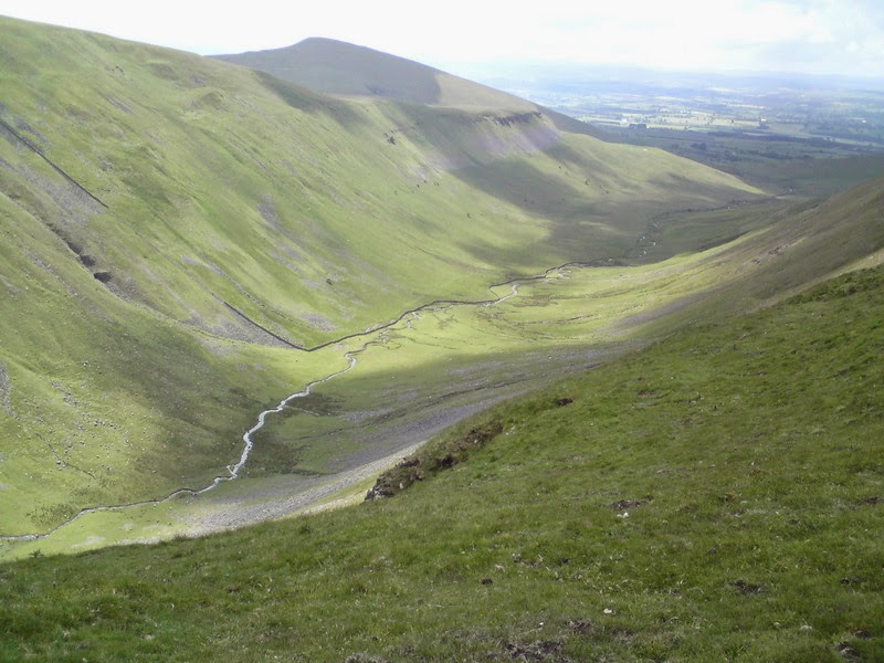
High Cup Nick, a beautiful glaciated valley near Dufton in Cumbria. I camped here when walking the Pennine Way for the second time, Sept 2014. What a view to wake up to!


Monday, 19 January 2015

My Pyrenees HRP Diary - Introduction

This year, 2015, I will walk along the Pyrenees HRP from Hendaye on the Atlantic coast to Banyuls, on the Mediterranean Sea.

There are three long-distance paths along the Pyrenees: the GR10, which stays in France (and Andorra) throughout, the GR11, which stays mainly in Spain, and the HRP, the Haute Route Pyrenean, which says "Never mind all that up and down stuff, I want to go straight along the top." It stays as close as it can to the watershed of the range. It doesn't care about shelter, about shops or hotels, or even tracks and waymarkings, so it is a harder route to follow. But it has wonderful rewards.. some of the best scenery and uncrowded views the world has to offer.

I will record my preparations and progress here, hopefully something new each week, until the job is done... I hope you will follow this diary and walk along with me. I look forward to your comments on all I write, makes me feel I am not talking just to myself!

The next post provides an introduction to me and how I got interested in walking..

Jerry

Below is a photo of the starting point for both the HRP and the GR10 in Hendaye, taken in 2013. 


... and this is the Atlantic, just a few yards away. Those are my footprints! This one was taken in 2010: