My Pyrenees HRP Diary - Introduction

This blog was begun in 2015, to record my walk along the Pyrenees HRP from Hendaye to Banyuls. If you want to read about that, I suggest you start here.

But that is all in the past now, and I have expanded the blog a little to cover more recent events.. such as:

Pennine Way 2024
Snowdonia Way 2017
Hebden Bridge 2015
Equipment Reviews
North Downs Way 2017
Pennine Way 2019

I hope you will find something interesting. Please do provide a little feedback or comment, and if you are interested in something that I didn't say enough about, please let me know .. happy walking!


Jerry

Sunday, 30 June 2024

Pennine Way 2024 - Some Final Thoughts

 There is a photo album of the walk, here.


 Lots of eyes follow you along the Pennine Way now..


If it is your fourth Pennine Way it is easy to get a bit blase.. done it all before, that sort of thing. But I knew I was underprepared and I was much relieved to find I could still cope OK with a hilly, 20 mile day. I have put some more specific thoughts below. 

The route:

When I did the PW the first time in 2009, I religiously followed the official route, stile by stile, all the way. I think you should, don't you? For the subsequent traverses I felt able to fiddle with the route a little, for example one time I went from Alston over Mohope Moor and on to Bardon Mill. From there you can walk up direct to where the PW crosses Hadrian's Wall. Another time I went from Lothersdale over to Skipton and on to Kettlewell, Great Whernside, Buckden Pike and Aysgarth before going over Buttertubs to rejoin the PW in Hawes. Much more strenuous that was, than the official route and I would not want to do it now; but interesting.

This time I did none of that, I kept to the official route throughout bar a couple of minor shortcuts. I even followed the route along Hadrian's Wall (which I find tedious in the extreme, see below) as instructed, though I have a better plan in mind for the next time.

A note on mileages:

I have gone through the posts and added the tracklog mileages, which come from my GPS and are accurate. The other mileages shown come from my stepcounter. It is very accurate at counting steps but to produce a mileage figure it has to rely on my telling it my average step distance (81cm, if you're interested). This works quite well on the flat but if you are going up (or down) something like Cross Fell your step distance falls a lot. So the difference between the mileage figures is actually quite interesting as it is a measure of the difficulty of the day. The more ups and downs there are, the more optimistic the stepcounter figure is likely to be. The stepcounter also measures the entire day's activity, not just the PW route that the tracklog does.

A health update:

Before starting off, I could not really claim more than average fitness. I do a fair amount of walking but in the year so far I had only done one walk of more than ten miles in a day. In April I did a three day walk with a full pack, about 55 miles in total. This went reassuringly well but is quite inadequate as a preparation for doing the PW. I should have done a week long walk a month or less before setting off, as I did do on my three previous PWs. The result was that on day 1, from Edale to Crowden, (which is a long 18-20 mile day with significant ascent) I was pretty done in, by the time I reached the Crowden campsite. The next day was shorter (and far, far wetter!) and went a bit better, and so on. My muscles reacted really well to the situation and after about a week, I had toughened up considerably. My lungs also improved but took longer and steep climbs took time, right to the end.

In my 74th year, I did worry about how well my ageing body can withstand the rigours of a long walk like this. The answer is, surprisingly well on the whole, with certain reservations.

My knees, which are not good, I saw as a weak point but in the event they held up really well. One of them swelled up a little but I had no pain and there was no impact on my walking.

My feet, normally so resilient, developed two blisters which is very annoying and even embarrassing given that I NEVER have blisters normally, not in over twenty years.. I am blaming my boots. They are good boots but they were quite new and they have a very wide toebox which I think allowed a bit too much movement, especially when the boots got damp or wet inside.

The most significant problem was my back. Over the final week, I developed a back problem which caused me real concern. I've had back trouble occasionally for most of my life but never before while walking. I don't know what set it off this time, it could have been something completely random, it could have been the result of carrying a 10-12kg pack for so long, I just don't know. It is concerning because it can easily become quite crippling .. how can you walk the PW if you can't manage to put your own socks on?! Fortunately it didn't get quite that bad, and I took ibuprofen for the last few days, which seemed to help.

Equipment Review:

I have always tried to carry as light a pack as I reasonably can. See my kit list for details.

For this walk I bought two new pieces of kit, Ultimate Direction waterproofs, and some Hoka Kaha II walking boots. Both did very well I thought, the waterproofs were waterproof, and they are very, very light. The boots were comfortable and robust, and their very wide footprint helped when traversing the frequent bogs I encountered. Yes I got blisters, but I would hope to avoid that next time, perhaps by padding the toebox a little, to reduce foot movement.

A note about Hadrian's Wall

Hadrian's wall is three feet high! And in serious need of repair. And in several places, not really Roman at all. Before you say "Oh no! It's a historic monument" fine, but we don't complain about the Tower of London, or Dover Castle being kept in good repair; nor the Great Wall of China, for that matter. All those pictures you've seen of the Great Wall (or visited, perhaps) are 20th century reconstructions. I wish we could rebuild a mile or two of Hadrian's, to show it properly, as it was in its glory days. If the Romans could do 75 miles of it I'm sure we could do two; and I think it would give a much clearer idea of what it was like, and be a more fitting memorial to it, than being shown a tatty wall of doubtful authenticity, or what is basically a hole in the ground and being told it is the best preserved lavatorium in Britain...

Accommodation Review:

I stayed at the places listed below. I have done Tripadvisor reviews of most of them, the items include a link to the review.

I also want to mention two places I visited, Clove Lodge, near Bowes, and Honeysteads farm which is about six miles before Bellingham. Both of them offer refreshments to tired walkers in return for a voluntary donation, and both are run by absolutely lovely people. Do pop in if you pass, even if only to say hello. I was grateful to both, but especially to Norman and Patricia (?) at Honeysteads, they kept me going on a long and tedious trek from Greenhead to Bellingham.

Overall I was well pleased with my accommodation choices, there is not one I could not recommend, with the single exception of Tan Hill Inn. I was about 12 the first time I went there, and I have been dozens of times since. I love the place, and it is a crying shame to see it taken over by impersonal corporate business. See the review ..

Ollerbrook Barn, Edale

Crowden C&CC campsite

My friend Wayne's house (not reviewed!)

An Airbnb in Hebden Bridge (see below)

Winterhouse Barn in Cowling

YHA Malham

Campsite, Horton in Ribblesdale

YHA Hawes

Tan Hill Inn

Teesdale Hotel, Middleton in Teesdale

(wildcamp at Hannah's Well, by High Cup Nick)

YHA Alston

Greenhead Hotel hostel

Campsite, Bellingham

Byrness House... a bit different, Byrness House is. No reviews since my last one in 2019 (!) but I definitely will stay there again in 2029, if possible..

Castle Hotel, Berwick-upon-Tweed

YHA Edale

The Hebden Bridge Airbnb was a lovely place to stay, an interesting building and very central, and the host, Mike, was really nice. Unfortunately I took against the Airbnb website, had a lot of trouble logging in, and found it very intrusive. So I can't put on there the five star review he deserves. But if you are better at handling Airbnb than I am, look for a central Hebden Bridge Airbnb for two, with Mike as your host. He is charging £42/night at present I believe, good value for the area and highly recommended..

Tips for intending Penninewayers:

  • You can't be too fit; and the first day from Edale to Crowden is no place to discover that you aren't fit enough. Only a third or less of those that start, intending to walk the whole distance, actually do so. The PW is a hard walk.
  • Prove yourself by doing a week's walk, if you possibly can, carrying the same pack, a month or less before you set off.
  • When you get back from that, look through the pack and remove anything it turns out you didn't need. You would be amazed at the number of folk who have to post stuff home from Hebden or similar. The question is not "Will this come in handy." The question is "What's the downside if I don't take it?" Taking a huge heavy pack is not manly or clever, it is daft. The lighter your pack, the more you will enjoy the experience.
  • What you do need, can you make it lighter for a reasonable cost? I swear by my electric toothbrush but no way am I carrying it up Cross Fell. Using an ordinary one for a fortnight won't kill me. These little things really do add up..
  • Get the big three as light as possible: rucksack, tent, sleeping bag. Get as close to 500g for each as you can manage or afford. Also remember that with food and drink, you only need to carry enough to get to the next supply point.
  • Look after your feet. I have a page about footcare, it's so important. Blisters are a pig.
Finally, be aware that the biggest difference between a walk and a long walk like the PW is the mental side of things. You will find that somehow, your emotions have become magnified, both the highs and the lows, often over quite trivial things. At some point, you are likely going to feel depressed, fed up, why am I putting myself through this? etc. Beware the half-way point! Traditionally a time when such thoughts occur. But if you are expecting them, you will find them much easier to deal with. And don't forget, there will also be times when you feel on top of the world..


--------------------------------------

Did I miss something? If there is some aspect you would like to know more about, just let me know..


Sunday, 23 June 2024

Pennine Way 2024 - Day 19: Auchope Hut - Kirk Yetholm

Pennine Way 2024 - Day 19: Auchope Hut - Kirk Yetholm 

Distance:   7.4 miles      Total: 292.92 (Tracklog: 7.44) Steps:  18,222

Things seen: Free beer, and a certificate..

----------------------

I set off about 8.30am, with a better opinion of the Spine race and its volunteer helpers than I had before. Then one last challenge,  climbing The Schil, followed by a gentle trundle down into Kirk Yetholm. My fourth Pennine Way was completed.

All the usual photos, including "winning" the Spine race, my fourth certificate and a free half of beer 🍺 ... followed by a free pint of lager, courtesy of my friend Wayne. Thank you, Wayne! I hope to reciprocate before too long...?

After a (frankly mediocre) lunch at the Border hotel, I decided to try to get to Berwick-upon-Tweed, as it seemed a more interesting place to spend time waiting for my trains tomorrow. The advertised bus to Kelso failed to appear, but I got talking to two cheerful men who were being picked up by their spouses. When their car arrived, they offered me a lift to Kelso which I gratefully accepted. In Kelso there was an hours wait for the bus to Berwick-upon-Tweed. When it came, another pleasant surprise. My bus pass, which does not work in Scotland, does work on this trip because Berwick is in England. So I got all the way for no cost.
I got a room at the very nice Castle Hotel, near the railway station, and settled down for the evening with a warm glow, a nice glass of wine, and a bad back...

Me at The Schil  Even my lucky cap is showing its age...
 

It took me longer to persuade the phone to take this, than it took me to climb up there..
 
the Border country beyond Kirk Yetholm, which is hidden behind the mind in the middle

"Stranger unexpectedly wins Spine race"
 
Certificate No. 4

When I get home I will do one final post, lessons learnt, equipment update, health update etc.

Pennine Way 2024 - Day 18: Byrness - Auchope Hut

Pennine Way 2024 - Day 18: Byrness - Auchope Hut

Distance:   20.7 miles      Total: 285.52  (Tracklog: 18.32)  Steps:  41,829

Things seen: More Spine racers, some friendly race organisers, and the Cheviot hills at their best.

‐‐-----------------

At last, a *good* day!

I set off from Byrness House about 8.30am, with clean clothes and a huge packed lunch. There is a stiff climb for the first hour or so up to the moors, and then a long walk the full length of the Cheviots which is really rather lovely, at least in the good weather we are finally having now. I reached the first refuge hut at 8.3 miles from Byrness by about 12, and stayed there a while talking to the Spine organisers.. then set off with the aim of reaching the second hut, at Auchope. The race had commandeered the huts, but I could camp nearby.  I meandered along at my own pace, reaching the second hut around 7.30pm. Shortly before, I was overtaken by a Spine racer who had started from Edale the preceding Sunday morning. So, Edale to Kirk Yetholm in five days.. an average of at least 55 miles each day. I told him I had done the same, albeit starting a fortnight earlier than him, and he said "You are doing it right, for the fun and enjoyment. We just do it for the gruelling." Then off he went...

I put my tent up at the second hut and chatted to the race staff there. They were concerned because two entrants had left the first hut, in danger of being disqualified as over the time limit, and had not been seen since. Eventually two of the staff set off back up the hill to look for them. One had collapsed completely, and had to be carried off the hills by a mountain rescue team. The other had revived a bit and they walked him down to the hut. He was a bit crabby about having to do this, I think he had hoped for a comfy stretcher, and even the next morning was sounding off a bit. I saw his feet, they really did not look good. Still he was able to walk down Into KY with one of the support staff. 

A view from the Cheviots. The Auchope hut and accompanying tents are visible on the saddle in the distance, though you might need a good screen to see it. 

The views all across the Cheviots are magnificent, it is so hard to capture them on a phone!

a lot of cotton grass around this year. 

the Auchope hut, with Spine support staff and some tents.. not put mine up yet. 


Saturday, 22 June 2024

Pennine Way 2024 - Day 17: Bellingham - Byrness

Pennine Way 2024 - Day 17: Bellingham - Byrness

Distance:   17.1 miles     Total: 264.82 (Tracklog: 15.54)  Steps:  34,563

Things seen: millions of fir trees, literally. More bogs, and some friendly Australians.

‐‐-----------------

If not actually a good day, this was a much better day than yesterday. Shorter for one thing, and the unrelieved lines of lifeless spruce trees were enlivened by conversations with some Aussie walkers, which there seen to be plenty of along the PW. There was a cheerful couple who said they were doing LEJOG, though their packs seemed quite small. Can you get baggage transfer for the entire length of the country? They were quick though and soon disappeared into the distance. Then I criss-crossed with two other couples from Sydney, for the rest of the day. No names, unfortunately, and for some reason I took no photos all day. 

I got to Byrness and the welcoming arms (metaphorically speaking) of Kate at Byrness House. I have stayed here before, and it was nice to see her again. After a nice salmon dinner I settled into a kingsize bed and slept well, knowing that there was  "just" the Cheviots to go, and then we are done. Kate did a clothes wash for me so I might even look presentable on the finish line...


for some reason this was the only photo I took all day. Why? Why??


Pennine Way 2024 - Day 16: Greenhead - Bellingham

Pennine Way 2024 - Day 16:  Greenhead - Bellingham

Distance:   25.7 miles      Total:  247.72     (Tracklog: 22.10)   Steps:  51,928

Things seen: some bunnies. an old wall badly in need of repair. Lots and lots of people. One Spine racer

‐‐-----------------

This was a nightmare day, disastrous. 

I left Greenhead about 8.45am and headed off up to Hadrian's Wall. Once I got there I followed the PW alongside the wall. This was difficult, because it seemed to consist mainly of steps, so steep it is both up and down. And people. . And oh yes, it rained. It follows the wall for about 7 miles, and for one reason or another, it was 2pm by the time I finally got to Cuddy's Crags, where the PW goes through the wall and heads off towards Bellingham (pronounced Bellinjam), with 12.5 endless, boggy miles still to go. It was almost 9pm by the time I finally got to Bellingham, and by then I was not a happy bunny. Everyone had stopped, serving food, though I did have a much-needed pint of Stella in the Cheviot hotel. Then off to find a campsite, pitch the tent, and then to the only food still available in town,  the Nazeem Indian takeaway. I had "classic lamb curry" which was indeed just a I remembered it from student days, half a dozen lumps of very chewy meat in a curry sauce. And a pappadom and some pilau rice. Finally got to sleep about 11.30am, rather tired. 

Today I saw my first Spine racer.. the race does rather take over the PW, while it is on. The Alston hostel was a checkpoint, thus fully booked for the week following my stay there. 

A Hadrian's bunny

this is Milecastle 42. Exciting! (not)

Some wall. 

Some more wall. 

Shitlington Hall, always good for a titter. Shitlington Crags can be seen up behind. 


highlight of a difficult day


Pennine Way 2024 - Day 15: Alston - Greenhead

Pennine Way 2024 - Day 15:  Alston - Greenhead 

Distance:  17.1 miles      Total:  222.02     (Tracklog: 16.01)   Steps:  34,501

Things seen: a huge hare; birds including more lovely curlews. 

‐‐-----------------

This was a better day than most (I am reserving the term "A good day" for now!), because I did cheat a little. I discovered that there is a footpath called the South Tyne Way that goes all the way from Alston to Haltwhistle, along what was once the railway track. I had booked a bed at the Greenhead hostel, or I would have followed it all the way,  but I walked along it as far as Lambley, before rejoining the PW, having saved a little distance and several hills. It was a pleasant diversion, enlivened by a huge hare that sat and looked at me until I was only a few metres away, before lolloping off. It was fine to start with but it did rain after a while, of course it did. There was some sun too, though. 
The remaining route to Greenhead was (very) rural fields and countryside to start with, but then came Blenkinsopp moor, possibly Britain's boggiest place. There are different types of bog. There are the little ones you can step or jump over. There are bigger ones where a bit of a detour is needed. Then there are the ones where you seem to be completely surrounded by swamp and have no clue how to escape without wading. Blenkinsopp(ing) moor has several of these. 
Eventually I found my way to Greenhead Hotel, around 5pm. The hostel is opposite, and run by, the hotel; it is in a converted "primitive methodist chapel." Only religion can make being primitive into a boast. I found the hostel a little bit spooky, but the hotel food was excellent. 
[An aside: in Maidstone there is a "Strict and particular" baptist chapel. You can just imagine them saying "This will bring the punters rolling in" as they chiselled it over their entrance.]

Between Alston and Slaggyford the railway has been reopened as a steam driven, narrow gauge line, here is the path, the railway, and the river S. Tyne.

River South Tyne 

Lindley Halt


Sunnies on for the first time since setting off. 

Greenhead hotel 

Sunday, 16 June 2024

Pennine Way 2024 - Day 14: Alston rest day

Pennine Way 2024 - Day 14:  Alston rest day

Distance:  1.3 miles      Total:  204.92        Steps:  3,048

Things seen: Alston, a pleasant, quaint little town. 

‐‐--------------------

A quiet day today, recuperating after the efforts of yesterday. 20+ miles including those big fells, mostly in the rain, took it out of me. I have various aches and pains, the only one that is really troubling me is back pain - not usually a problem when walking - and I have been doing my back exercises to help settle it. YHA beds don't help. I am longer than they are..

Done a little shopping, got everything wet dried out, and brought this blog up to date. Had an indifferent Sunday lunch at the Alston House Hotel.

The Spine Race  started today apparently. As a result, this hostel is fully booked for the next week or more. In fact there is very little, between here and Kirk Yetholm. And none at all, in KY. I hate the Spine Race :-( (but, see later on..)

No photos today as I forgot this morning, and it has been raining steadily since 3pm.

Weather update:

- 11 walking days, of which:

- constant rain, sometimes heavy  3

- showers, sometimes heavy 4

- occasional light showers 2

- no rain at all, at least while walking 2


Pennine Way 2024 - Day 13: High Cup Nick - Alston

Pennine Way 2024 - Day 13: Hannah's Well - Alston

Distance:  21.3 miles      Total:  203.62   (Tracklog: 19.38)     Steps:  43,143

Things seen: rain, rain and more rain.

-------------------------

Well, today was quite a day. Having camped at High Cup Nick, it rained all night but when I woke up about 5am it had eased off and soon stopped. I got up and packed away the tent, set off about 6am. The plan was to walk across the moor to pick up the PW trail coming up from Dufton.  Mostly that was fine but for the last mile or more there was no path so it became quite hard work. Also it started raining again. Still I got to Knock Old Man by about 8am. Then follows a series of large fells, Great Dun Fell, Little Dun Fell, and then Cross Fell, at 893m the highest point in England outside the Lake District. Since you have to go down after getting to the top of each, in order to reach the next one, it is all quite gruelling. I got to the top of Cross Fell, and luckily the rain stopped again. I went downhill to Greg's Hut, by the time I reached it, it was raining again and that carried on for the rest of the day. 

The long and stony path down into Garrigill seemed endless in the steady rain, and so did the path from there to Alston. Less said about that the better, I was glad to reach the hostel at Alston. 4 PWs, 4 visits to this welcoming hostel. Every stitch of clothing I was wearing was soaked through. I got changed, put it all into the drying room, and went for a beer and something to eat with Trevor. He and Sula had spent the previous night on Greg's Hut ("very cold") and were now staying at the hostel. 

I have another rest day, my third and last, tomorrow and it is just as well!

Not many photos, because of the weather:

Some fine views along the ridge above High Cup Nick, weather permitting


A lonely and neglected trig. point on Dufton Moor

the trig. point at Cross Fell. Superb views right to the Lake District, when no clouds in the way.. 

Pennine Way 2024 - Day 12: Middleton-in-Teesdale - High Cup Nick

Pennine Way 2024 - Day 12: Middleton-in-Teesdale - Hannah's Well

Distance: 18.2 miles  Total:   182.32   (Tracklog: 17.15)   Steps: 36,695

Things seen: some redshank,  and yet more lovely curlews. And the glory that is High Cup Nick. 

-------------------------

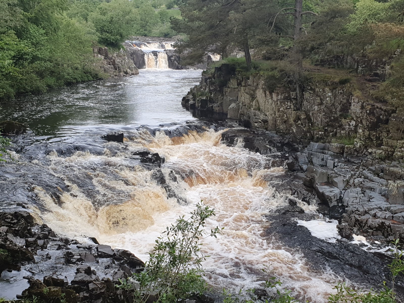
Set off in good order from the Teesdale, about 8.45am and ploughed steadily up the Tees valley, past Low Force and High Force, both in good flow as well they should be after all the rain. Today it started raining about 10am and carried on until about 2pm, when it started to brighten up a bit. A good set of birds today, most sadly unidentified, but at one point I said to a man standing nearby "Do you know a lot about birds?" And he said yes he did. I said "What are those there, that go wheep?" And he said "Those are redshank" in that way that implies that everybody knows that. 

Much of today's route was straightforward, but there is a tricky bit in the mile before Cauldron Spout involving scrambling over rocks, care needed when they are wet and slippery and you have a heavy pack. Cauldron Spout itself has to be scrambled up too. It is the outflow for Cow Green reservoir so all artificial. It can be quite impressive, but not much was being let out today. 

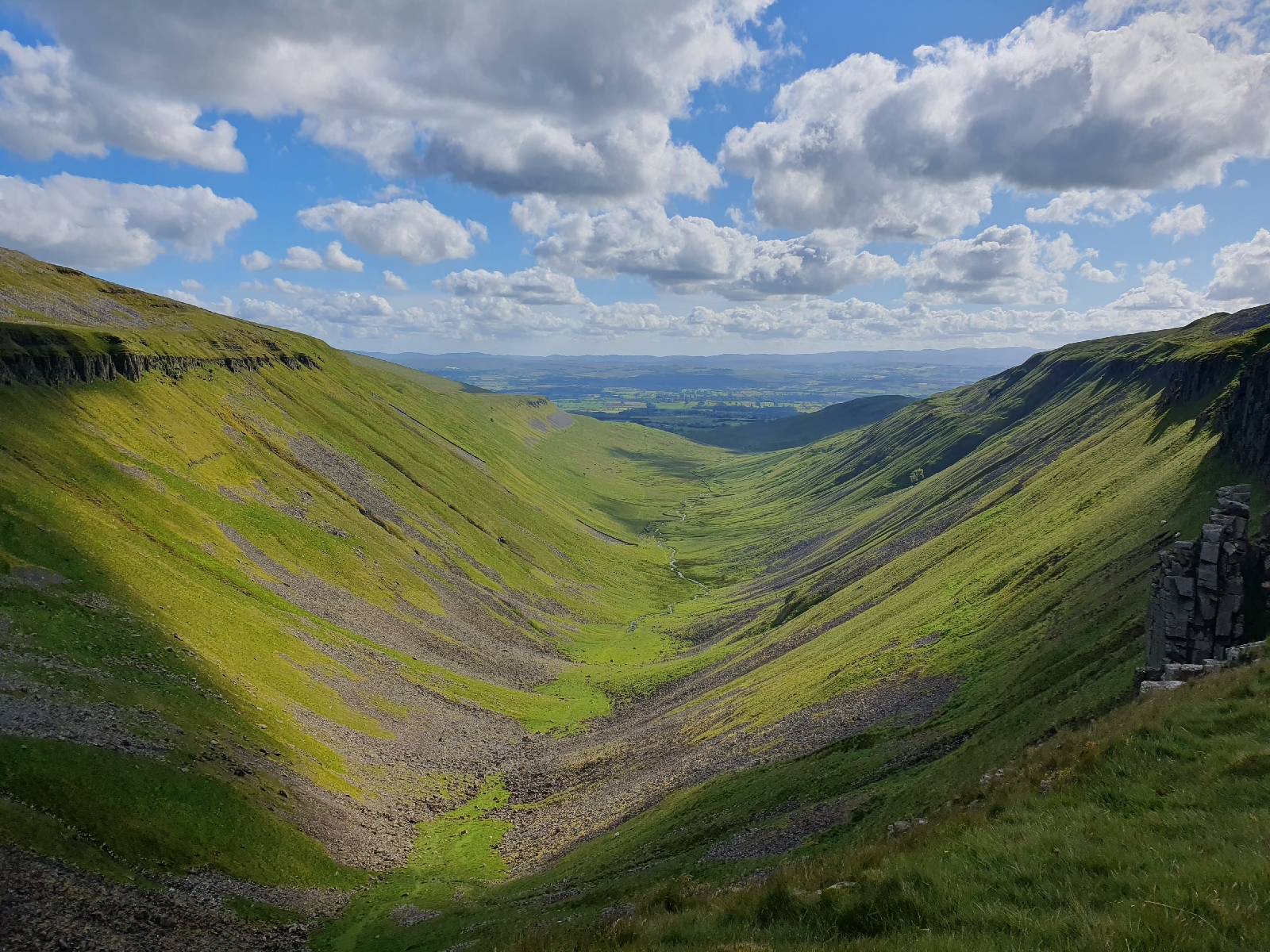
Then another long flat stretch before the climb up to High Cup Nick.  This never fails to impress, though I have been here several times before. The weather now was bright and sunny so I decided to camp there for the night and not go down to Dufton. It is a fine place to spend time. 

Low Force


High Force...
.

Juniper trees, lots of them hereabouts..

Wife Sue tells me this is a Northern Marsh orchid. Certainly very pretty and lots of them around here

This is Tamsin and Tom. We criss-crossed all day and when I told them I was camping here and was a bit short of food, they most kindly donated two Penguins and some nuts to the cause..

Tent, with view... it is next to a stream, Hannah's Well, supposedly a spring but the map doesn't actually say that, so I did filter the water. 

High Cup Nick. Expand the photo if you can


Thursday, 13 June 2024

Pennine Way 2024 - Day 11: Middleton-in-Teesdale Rest Day

Pennine Way 2024 - Day 11:  Middleton-in-Teesdale Rest Day  

Distance:  0.6 miles     Total:  164.12          Steps:  1,312

-------------------------

A bit of housekeeping, washing socks etc, a trip to the Co-op for supplies, and a successful search for somewhere to print off some more crosswords.. amazingly, I am still keeping them up to date. No library in Middleton, the Tourist agency is closed, but the Upper Teesdale Agricultural Support Goup were very helpful.

It has been raining all afternoon and evening, and the weather for the next few days is looking very iffy indeed, with thunderstorms a possibility. Not sure if Cross Fell is the best place to be in such circumstances. At 893m (2930ft) it is the highest point in England, outside the Lake District. All I can do is keep an eye on things.. tomorrow should be OK, though walking down to Dufton is looking more sensible now than camping at High Cup Nick. After that, we shall have to see. 

The Teesdale Hotel is a very comfortable place to stay. Recommended.