My Pyrenees HRP Diary - Introduction

This blog was begun in 2015, to record my walk along the Pyrenees HRP from Hendaye to Banyuls. If you want to read about that, I suggest you start here.

But that is all in the past now, and I have expanded the blog a little to cover more recent events.. such as:

Pennine Way 2024
Snowdonia Way 2017
Hebden Bridge 2015
Equipment Reviews
North Downs Way 2017
Pennine Way 2019

I hope you will find something interesting. Please do provide a little feedback or comment, and if you are interested in something that I didn't say enough about, please let me know .. happy walking!


Jerry

Tuesday, 25 July 2017

Thoughts on Completing the Snowdonia Way.. and Photo Gallery

Well, my first thought is that I haven't fully completed it, after all. I did all of the lower route, except for one or two bits where I altered the route to make it more interesting, eg adding Cnicht and Glyder Fach to the route North from Machynlleth to Conwy. As for the mountain route, I did most parts but not all, as well as a couple of parts not on either route, such as the Snowdon Horseshoe. But I had a good time..

There is a PHOTO GALLERY here .. with lots of photos and captions

That said, what do I think of Snowdonia, and of the Cicerone Snowdonia Way guide and the two routes it contains? Well, all of them have plus points and minus points:

Points in favour:

  • Snowdonia National Park and its environs certainly are highly scenic and attractive areas, worth a visit in anyone's money
  •  They include some proper hill walking, climbing and scrambling.. proper mountaineering too, if one is so inclined
  • The Snowdonia Way guidebook is well written, concise but not overly so. I could find no fault with it, apart from a couple of trivial points
  • The two routes are distinct and different. The lower route is suitable for any walker, but you will get only distant glimpses of Snowdonia proper. The mountain route on the other hand has some quite hard days and some quite difficult navigation, especially in poor visibility. But most of Snowdonia's higher points are included.
  • It is good that the routes overlap and can be intermingled according to preference (or the weather)
  • The Snowdon massif was impressive and enjoyable, despite the crowds. It helped that it was sunny then!

Points against:

  • It is fair to say that despite its popularity, much of Snowdonia really is not well geared to tourists and visitors. Of the towns I visited, some (Dolgellau, Colwyn, Machynlleth) were welcoming and had good facilities. Some on the other hand, (Beddgelert, Penrhindeudraeth, Bethesda, Trawsfynydd) were not, and I have to say made me feel uncomfortable and unwelcome. I will avoid these places in future. If you intend staying or eating in any of them, I recommend that you book up in advance, or use campsites, which are plentiful and tend to be friendlier and more flexible.
  • The weather! Crib Goch according to Wikipedia is the wettest place in the whole of the United Kingdom, with over 176" rain per year .. 1/2" day on average! I was lucky there, but over the sixteen days it rained on every day but three. In July! It will rain a lot, in Snowdonia..

In summary, I definitely would recommend Snowdonia and the Snowdonia Way. You will have to be philosophical about the weather, and it will be best to book accommodation and meals in advance if you can, or use campsites. My turn-up-and-see approach did not work very well for me.

Accommodation

I stayed at, or ate at, or visited, the following establishments. I have done reviews of most of them on the invaluable Tripadvisor, and posted links to them below:

Dolgeylynen B&B, Machynlleth (Elinor)
Torrent Walk Hotel, Dolgellau
Tafarn y Gader Tapas, Dolgellau
Cross Foxes Hotel, Trawsfynydd
Cae Adda campsite, Trawsfynydd
Busy Bees Caffi, Penrhindeudraeth
National Trust campsite, Hafod-y-llan
Pen-y-Gwryd hotel
Victoria Bunkhouse, Bethesda
Y Llangollen gastro pub, Bethesda
Bryn Guesthouse, Conwy (Alison)
Erskine Arms, Conwy
Castle Hotel, Conwy
Joys of Life, Bethesda
Campsite, Nant Peris
Vaynol Arms, Nant Peris
YHA, Pen-y-Pass
Royal Goat Hotel, Beddgelert
Tanronnen Inn, Beddgelert
White Lion, Machynlleth

Of all the above, the best hotel was the Torrent Walk, the best campsite was Cae Adda, and the best B&B was the Bryn, in Conwy. Easily the worst hotel was the Royal Goat. I wouldn't say I had a bad campsite or B&B, one or two of the pubs were perhaps a bit iffy.

Well that's it for the Snowdonia Way. I have some unfinished business here, in particular a wish to go over the rest of the Glyders and the Carneddau in good weather, and to go to the top of Cader Idris. So one day I will return.. in the meantime I have also done a brief equipment review.


If you have any questions, please do get in touch.. you can comment on any of these pages, and it will get to me. If you include an email address, I will reply to that


Snowdon Day 14

Dolgellau - Machynlleth, 15.8 miles

The forecast for today was dire, and so it proved. It rained all day, sometimes in buckets, sometimes just steady rain. So, no point in trying any mountainous stuff, I just got the full rain gear on and ploughed away. I had done almost all of this route on day 1, in the other direction, and it was surprising how different things looked just because I was going the opposite way - insofar as you could see anything, that is. I got to Machynlleth at about 6pm, and was able to have a shower and a complete set of clean clothes from the stuff I had left in the car.

Not much more to say, really, the walking is done. It has been an enjoyable and occasionally quite challenging fortnight. I will do another post, of thoughts on completing the Snowdonia Way, in a day or two


Looking back towards Cefn Naw Clawdd. The only photo I have of this day, because of all the rain.

Snowdon Day 13

Up Cader Idris from Dolgellau, 10.9 miles

OK, this day could have gone better I'm afraid. Because I saw it as a rest day I had a lie in and a leisurely breakfast, then it rained for a while, so I did not start walking until after 9.45am. I was planning to walk up to the highest point of Cader Idris, which is called Penygadair (893m, 2,930ft). There is a shelter there. No problems to start with, the first mile or two is up narrow lanes. The fun starts past a farm called Bwlch Coch, where you start walking over boggy ground full of reeds, gullies and such, and the path totally disappears. I found my way through it all eventually, but it took quite a long time. It was well into the afternoon by the time I was on Gau Graig, the ridge leading up to the top. I ploughed on up, getting a little nervous about the time, until I got to the top of Mynydd Moel (863m, 2,831ft). This is the summit before Penygadair and only 30m lower, though as usual you go must down and then back up again. Surprisingly for such a well-known hill, i saw nobody all day, not a soul.
I sat on Mynydd Moel for a few minutes, and then decided to go back down, partly for reasons of time, partly because the weather was still iffy, and partly because frankly Penygadair looked pretty much the same as Mynydd Moel with much the same views. Looking back now I can't imagine why I didn't carry on, it is not as if daylight was an issue, but there we go.

Cader Idris. The further lump is Mynydd Moel, you can't see Penygadair yet


I floundered back down the hill side, a little quicker than coming up because now I could follow the quite detailed instructions in the Cicerone guidebook. Even so I had to climb a couple of barbed wire fences, because the gaps the guidebook mentioned did not exist. I got back to Dolgellau about 6.30pm, after a full-but-very-slightly-unsatisfactory day.

Tomorrow is the last day, when I walk back to Machynlleth and my car.

Penygadair from Mynydd Moel

View from near the top of Mynydd Moel


Monday, 24 July 2017

Snowdon Day 12

Trawsfynydd - Dolgellau, 16.8 miles

For the second time, I had a good night's sleep at Cae Adda, and for once I took the trouble to cook myself a breakfast. Then I set off about 8am for Dolgellau. The plan was to follow the lower level route to Dolgellau and then spend two nights there. Tomorrow, a day trip up Cader Idris, then the day after walk back to my car at Machynlleth.


A huge bull encountered just after leaving the campsite.. he seemed quiet enough but I was glad of the fence


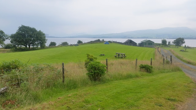
Farewell to Llyn Trawsfynydd. Cae Adda campsite is just beyond the small promontory that sticks out on the left side.

After that I just plodded on in mixed weather, showery but not steady rain.


I'm getting a little confused over my Snowdonia mountains .. is this the Rhinogs again? Could be ..

I got to Dolgellau about 5pm and checked into the Torrent Walk Hotel, which I had taken the precaution of booking that morning. I stayed there on day 2 and really liked the place. The Ritz, it is not - but it is cheerful and friendly, which seems less usual in Snowdonia than it ought to be. And the food is excellent, and the rooms are cheap. My room had a truly vast bed which filled it almost completely .. not sure why but it was comfortable.

Tomorrow, Cader Idris.


Snowdon Day 11

Beddgellert - Trawsfynydd, 20.0 miles

Wayne dropped me off about 8pm on the Monday evening, in Beddgelert. This proved to be too late to obtain any food, despite there being several pubs and restaurants in the village; they keep early hours and will not put themselves out. It was also almost too late to find somewhere to stay though I did eventually manage to do that, at an extortionate price with grudging staff. I did not find Beddgelert a welcoming place and will not return.. I will say no more about it.

After my exertions yesterday on the Snowdon horseshoe, I decided not to pursue the mountain route from Beddgelert which goes to Penrhyndeudraeth ("Penrhyn"). Added to which I doubted if it would be any easier to find food or a bed there than it was in Beddgelert. Instead, I decided to follow the lower level route which goes to Trawsfynydd, and stay at the friendly and cheerful Cae Adda campsite I had visited on Day 2. It was further (it goes through Penrhyn, but keeps going) but flatter. Some of the route would be the same as I had followed on Day 3, but a lot of it would be different, since I had amended the other route to finish at Nantgwynant instead of Beddgelert.

 Today was not so photo-tastic as yesterday, though the countryside was pleasant enough... a steady plod in mixed weather (translation: rained a bit!) and arrived at the campsite about 8pm.


 Llynn Tecwyn Uchaf reservoir

 .. and here we are, back at Cae Adda campsite and Claire and Derek were as friendly and welcoming as ever .. and this time, no mosquitos! None too speak of, anyway. There was a slight breeze, maybe a little wind moves them away.

I highly recommend this place, it has all required facilities and the surroundings are tranquil and idyllic. I promise to stay nowhere else around Trawsfynydd!


Snowdon Day 10

Snowdon horseshoe back to Pen-Y-Pass, 8.6 miles
.. which just goes to show how misleading mileages can be. The two hardest days so far, turn out to be also the shortest!

When I got back to the Pen-y-Pass hostel I found I was in a four-berth room with two other men, and got chatting to one of them, Wayne Boothman. It turned out that he was intending to attempt Crib Goch the next day. I had been thinking I would like to do the same but I was a little nervous, especially about doing it on my own. So when he assured me it was easy peasy, just like a walk in the park really, not at all difficult, oh no - I agreed to accompany him. My route tomorrow was via the summit of Snowdon and then down the Watkyn Path to Beddgelert. Wayne was doing a circular route called the Snowdon Horseshoe, so we would part at the summit.

We set off after breakfast, 8.15am or thereabouts, up the Pyg path to the junction where Crib Goch begins. It was another beautiful sunny day:


The path soon becomes, well, essentially vertical:


.. but there are plenty of hand and foot holds in the shattered rock face so although it needs care it was not technically very difficult. It took a while to get to the top, because Crib Goch is one of the higher points of Wales in its own right, at 923m (3,028ft) high. When I finally got there, I saw that there was still plenty of work left to do..


First of all, you have to scramble along the knife-edge ridge (you can see some people doing that, in the photo above). Then there are a couple of notches that have to be negotiated. finally you drop down to a further ridge and climb up it to the summit of Garnedd Ugain, the second highest mountain in England and Wales at 1065m (3,494ft). And then round the next col to Snowdon (1085m, 3,560ft). Snowdon is the pointy bit directly behind the Crib Goch ridge, Garnedd Udain is the one on the right.

Jerry & Wayne, ready to ridge walk..
 Negotiating the ridge is not technically hard, it is the vast drops on either side that make it interesting. If you are either daft, or a gymnast like Wayne, you can trot straight along the top. If not then you can drop down a few feet and scramble along using the top for handholds. After you have done this you get to the first notch..


You drop down one side and then climb up the other, as this young Spanish couple are doing.


Note that they have brought their dog, a brave move that some others on the ridge rather disapproved of. They did complete the climb successfully however, and the dog seemed to enjoy it.

Eventually, we negotiated the two notches and the subsequent climb to reach the summit of Garnedd Ugain. Wayne made himself a friend for life, by reaching into the bottom of his rucksack and pulling out two cold beers! Wayne is wearing a GoPro camera on his head and "Grib Goch - the Movie" is scheduled for future release.. see here!

 After that it was an easy stroll round the col to the summit of Snowdon, at the back in the photo above. All this took quite a long time, and it was around 3pm before we were ready to set off again. Rather than me continuing down the Watkyn Path to Beddgelert, it seemed as if it would be quicker to carry on round the horseshoe back to Pen-y-Pass. Then Wayne said he would drive me down to Beddgelert, a matter of a few minutes and on his route in any event, an offer I gratefully accepted.


The route back follows this ridge .. not the path down to the right, it goes over Y Lliwedd (898m, 2,946ft) ahead and follows the ridge down left back towards Llyn LLyddaw reservoir. Easy, ne c'est pas? 

The dot is me climbing the East peak of Y Lliwedd (893m), photographed by Wayne who is on the West peak.

We eventually got back to Pen-y-Pass hostel around 7.30pm, tired but happy after a very full day. I am immensely grateful to Wayne for helping me to complete a walk I would hesitate to do unaccompanied. The weather was fantastic throughout the day - something of a rarity, since Crib Goch has the unenviable record of being the wettest place in the whole of the UK, averaging 176.1" of rain each year.

If you are wanting to have a go at this walk, and are fairly fit, and are used to mountain walking, I say do it - always provided the weather is good. Wait for a clear day; I would not want to do it in rain or even in cloud. You will need a full day, and it is best not to carry a 12kg pack, as I was doing!


Wednesday, 19 July 2017

Snowdon Day 9

Snowdon - sort of a rest day, 9.8 miles

It rained heavily overnight - no wonder we don't get very much rain in Kent, Wales seems to have cornered the market. I mean, this is July, and still it rains most days. I packed up as best I could and set off. Having finished up miles off route, my plan was to make my way to Pen-Y-Pass, where tomorrow's route began from. It was only about five miles up the road,  so i could walk there if need be.  but it seemed better to get a bus, so i could check in to the youth hostel there and do a bit of washing, have a shower, and maybe walk round a bit if the rain stopped. The weather forecast for today was poor but for tomorrow, much better. So i would be rested, and poised to climb Snowdon, and in clean socks too..

I found out when the bus was due and waited hopefully, but nothing came. I stuck my thumb out, and was pleased to pick up a lift in no time at all, from a very nice man who was part of the North Wales Mountain Rescue. Understandably he was pleased I had decided to cut yesterday's walk short because of the conditions. He said they had been called out 87 times, so far this year... So I got to Pen-Y-Pass before 10am, checked in, had a nice coffee,  did a little washing - they have a great drying room here - and had a look outside. 

To my surprise the weather had picked up, the rain had stopped and um, golly, what was that round yellow thing in the sky? So I thought I would go for a wander, nothing strenuous of course. From Pen-Y-Pass there are three main routes up Snowdon, the miners' trail, the Pyg  trail, and Crib Goch. The miners trail is the easiest, a broad gravelled path that crosses the llyn llydaw reservoir on a causeway. I could go as far as the lake and see how things were.
Two hours later, I was standing on the summit of Snowdon. For once it was free of cloud, the climb didn't look difficult (you should see some of those attempting it, though!) and I thought I shouldn't miss the opportunity. Snowdon without any cloud is a rare thing. There were a lot of people about, but on a sunny July Sunday that is only to be expected. I hung about at the summit for an hour, took some photos, had the most expensive bottle of lager ever,  and set off back via the Pyg track. Still a very popular route, but not quite so busy. 

Snowdon is the highest point in England and Wales, 1085m (3560ft)  so i suppose if i have to climb something twice in two days, it might as well be that. Tomorrow I plan to go up via Crib Goch, and down the far side to near Beddgelert. 

Pen-Y-Pass is a fine youth hostel, newly renovated and very comfortable. Nice people too, Greg was very welcoming and helpful. Apparently the fire alarm had gone off, and steel shutters had come down that they could not get back up again. And although the hostel is state of the art, their computer was running Windows 95 and very very slow. He dealt with these difficulties patiently and I did get to my room eventually!

The Miner's Trail .. wide enough for a car


The Miner's Trail crosses the reservoir on a causeway
Snowdon, with Llyn Glaslyn in front

Snowdon. Can you see all the people on top?
Now you can!


View from the summit. . You can see the sea, much of the coast of Wales in fact

Anglesey is also visible


Surprising amount of military activity around Snowdon. This is one of several very noisy Apache helicopters


Cheats' route to the top! The little steam locomotives are rather sweet.

Returning to the newly renovated YHA hostel at Pen-y-Pass

Sunday, 16 July 2017

Snowdon Day 8

Bethesda - Old Llanberis, 9.6 miles
Well, I might have walked less than 10 miles, but nevertheless this was a very hard day.
I elected to sleep in the barn at Joy of life, but for some reason I didn't sleep very well. I got up not long after 5am, and walked back into Bethesda to go to the Tesco there, which opens at 6am. I got some food items and set off again, feeling rather sluggish. It was cloudy and overcast but not raining. 

The first part of the route was to walk along the valley for a couple of miles, and then climb a steep hillside up to the summit of Carnedd y Filiast, 826m. I had a great deal of trouble finding the right path up the hillside. I could not easily enlist the help of the guidebook, as I was doing the route back to front. Also, the higher I got, the wetter, windier, and mistier it got. I did finally get to the summit, which had a small circular stone shelter. You could see why - by now the cloud was thick and it was raining steadily, but it was the wind that was concerning me most. I don't think it was quite gale force, but it felt as if it was. When a gust came, you had to stop and brace yourself, and wait for it to die down. I decided to carry on, if only because I didn't at all fancy scrambling back down that steep, slippery hillside ridge that had taken me the best part of two hours to climb.
So off I set, hunting through the mist for the stiles and other landmarks that would indicate I was heading in the right direction. I was high enough now that the terrain was a mixture of grassy bog and stone outcrops, but as I approached Y Garn (947m) the path got clearer and easier to follow. But by then I decided that I had had enough mountain walking for one day. It wasn't fun, what with the rain and the thick cloud, visibility 10m or less, but mainly, i was concerned that the wind was starting to reach dangerous levels. Of the two remaining peaks, Glyder Fawr was over 1000m and Glyder Fach I had already been up on day 5. Still, I might have continued if I could have walked across easily from y Garn to Glyder Fawr, only 50m higher - but no, I would have to go down 250m and then scramble steeply up 300m, and it just didn't seem worth the risks given the lack of visibility.
I saw that there was a footpath marked that went straight down the mountain to a point beyond Nant Llanberis, and took it. Even then the mountain wasn't finished with me, because the path was on the map alright, but could I find it on the ground? No. So I floundered down the hillside through the gorse and heather and bog, finally staggering out on to the busy A4086 about 3.30pm and walked back to Old Llanberis, which is like the actual Llanberis only without facilities. It did however have a pub and a campsite, and I made use of both to get a meal and an early night. The campsite had several very noisy tourist families, so did they keep me awake? No, not for a minute. 
NOTE: I am sorry that this blog has fallen behind a few days. The reason for this is that my lovely new but rather fragile Samsung S8+ phone fell out of my rucksack half way up Snowdon and is now not working properly. And it has all my photos on it! So now I am using my old phone.
Setting off up the hillside, looking back at Bethesda.. weather not promising!

Bilberries! Like blueberries but much tastier. Must have eaten pounds of them over the fortnight

The summit of Carnedd-y-Filiast, 821m. Shelter was needed!

Summit of Y Garn, 947m. I did not continue towards Glyder Fawr because no visibilty, and concerningly high winds

Coming off the mountain towards Nant Beris.. campsite visible in the left middle. Lower parts of the Snowdon massif behind

Looking towards Snowdon!

At the campsite, my tent at left

Saturday, 15 July 2017

Snowdon Day 7

Conwy - Bethesda, 19.7 miles

Set off at 9am .. a bit late for mountaineering but at least the weather was dry, cloudy but did not seem to threaten rain. 

The first part of the walk is similar to the inward route, and it seemed to take ages to get up to the Carneddau hills, but I got there in the end.. and there were Views! You could see the whole of Snowdonia, the whole of Wales, it seemed. I was a happy bunny. 

Eventually I wound my way down to Bethesda, intending to book into the same bunkhouse I used before.. and was amazed to be told it was fully booked! only two days before, I had been the sole inhabitant. So I had to go in search of somewhere to put up the tent for the night. I phoned a b&b with the ever so slightly creepy name of "Joy of Life," and they could not have been nicer. They said they were fully booked but had fields and a barn where I could pitch my tent. And then Iain drove into Bethesda and picked me up.. and they would not take any money. They have quite the facilities there.. caravans, cabins, cottages, b&b.. you can Google it. They are looking to sell but can't find a buyer. 

Heading up from Conwy towards the Carneddau

A last look back at Conwy from the same spot

Getting closer.. tricky navigation across these boggy uplands, with no clear path

Memorial to a crashed aircraft, a Liberator that was wrecked with all six crew in January 1944

Carnedd Gwenllian (926m) to the right, Foel-fras (942m) on the left.

Summit of Foel-Fras. Difficult to scramble over all these rocks!

Summit of Carnedd Gwenllian

Looking from Gwenllian along towards Carnedd Llewelyn and Carnedd Dafydd. I dearly wanted to walk over them but had not time to go and come back


Coming down towards Bethesda, the Glyder range and that appalling slate quarry detritis behind


Thursday, 13 July 2017

Snowdon Day 6

A rest day in Conwy.

Despite a lie in being the favoured option, I woke around 6 and sauntered about sorting out washing, showering, blog updating etc. until breakfast at 8am. Breakfast was fabulous, and confirmed Bryn as being a really top class guest house. I had also not realised, when arranging the walk, just how historic and interesting a place Conwy itself is. It has a lovely quay, a truly splendid c13 castle and an almost complete set of  fortified town walls erected by Edward I. So I set off to walk around them, of course, and explore the old town they encompass. I was amused by some of the information boards dotted about which said - translated into plain English - that the magnificence of the fortifications said as much about the stubborn bolshieness of the Welsh, as it did about the wealth of the English. Words to that effect, anyway and indeed the walls and castle are magnificent today. I cannot recommend Conwy, or indeed the Bryn Guesthouse, highly enough.

The rest of the day spent catching up on Times crosswords, (thank you Alison for letting me print them off!) and trying to work out how to read the guide book backwards, which I will have to do for the rest of the walk as it assumes I am starting from Machynlleth. 

part of the town walls, taken from the garden of the Bryn guest house!
.. and the guest house, taken from the castle wall
The town, the estuary and the castle, taken from the same spot 
on the quay. The red thing is allegedly the smallest house in Britain
Conwy castle, still as awe-inspiring today as it was built to be
The Conwy suspension bridge, built in 1826 by Thomas Telford. The structure to the right is a tubular railway bridge built in 1846 by Robert Stephenson.. not quite so scenic, but even rarer. Unique in fact